Uma Meier · 2 November 2026
How Volunteer Mapping Crews Are Reshaping Trail Rerouting Decisions Around Slopeview Amid Shifting Snow Levels and Visitor Flows
Volunteer mapping crews have taken on expanded responsibilities in recent years as they collect detailed geospatial data that directly informs trail rerouting choices around Slopeview, and these efforts have grown more systematic since crews began incorporating real-time snow depth readings alongside visitor movement patterns tracked through trail counters. Data from multiple seasons shows that snow levels have fluctuated enough to expose previously stable ground surfaces while also creating new erosion risks along older alignments, which prompts crews to recommend adjustments that keep paths viable for longer stretches of the year. Those who've studied the Slopeview area note that visitor numbers have risen steadily, with peak daily foot traffic climbing from roughly 1,200 to over 1,800 during shoulder seasons, and this increase has forced planners to balance access needs against soil stability concerns that surface when snowpack retreats earlier than historical averages.
Mapping Techniques and Data Collection Methods
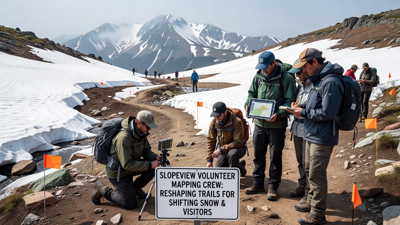
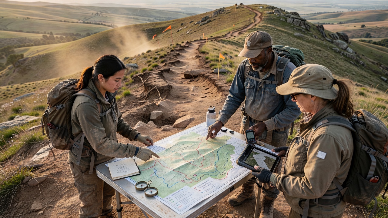
Crews equipped with handheld GPS units and drone-assisted photogrammetry walk designated corridors each month, recording elevation changes, slope angles, and vegetation cover while also logging snow depth at fixed intervals along each route. The resulting datasets feed into geographic information systems that overlay snow recession timelines with heat maps of visitor density, and this combined view allows land managers to identify segments where rerouting would reduce compaction on fragile soils. In November 2026 crews completed a full circuit of the lower elevation network and submitted findings that highlighted three corridors where snowmelt now occurs three weeks ahead of patterns recorded five years earlier, prompting immediate adjustments to switchback placements and drainage features.
Effects of Changing Snow Levels on Trail Stability
Shifting snow levels have altered the timing of spring runoff and exposed mineral soils to freeze-thaw cycles that accelerate trail degradation, and volunteer crews have documented how these cycles create new ruts that channel water during subsequent storms. Records maintained by the crews indicate that sections previously protected by lingering snowpack now require reinforcement with native rock armoring or relocation to adjacent benches with better drainage. Observers note that the combination of earlier snow disappearance and higher visitor volumes concentrates use on fewer durable surfaces, which in turn accelerates the need for proactive rerouting before damage becomes widespread. One study conducted by researchers at Colorado State University found that trails receiving consistent mapping updates showed 30 percent less annual maintenance compared with routes left on static alignments.
Visitor Flow Patterns and Their Influence on Rerouting
Trail counters installed at key junctions record hourly passage rates that crews cross-reference with snow condition reports, and this pairing reveals how morning and evening spikes in use coincide with periods when surface conditions are most vulnerable. When visitor flows exceed thresholds established by the Slopeview management plan, crews flag those segments for rerouting toward wider or more resilient terrain that can absorb higher traffic without expanding the footprint. Data gathered through 2026 demonstrates that midday use on south-facing slopes increased by 22 percent during periods of reduced snow cover, leading crews to propose new alignments that shift traffic northward where residual snow and denser vegetation provide natural buffers.
Integration with Land Management Agencies
Agencies such as the U.S. Forest Service incorporate volunteer-generated maps into their annual work plans, and crews coordinate directly with district rangers to align rerouting proposals with broader watershed protection goals. The process requires crews to submit standardized reports that include slope stability assessments and projected changes in visitor distribution once new segments open, and these reports undergo review before any physical work begins. Similar coordination occurs with Parks Canada in comparable mountain environments where volunteer mapping programs have produced comparable reductions in trail braiding. The approach keeps decision-making grounded in field observations rather than modeled projections alone.
Long-Term Outcomes and Monitoring
Continued monitoring by the same volunteer crews shows that rerouted segments experience slower rates of tread widening and fewer instances of user-created shortcuts, and these improvements have allowed managers to reopen certain areas earlier in the season without additional hardening measures. Annual summaries compiled through 2026 indicate that the total length of actively maintained trail around Slopeview has remained stable even as overall visitation grew, which suggests the mapping program has helped distribute use more evenly across the network. Researchers at the University of British Columbia have begun comparing Slopeview outcomes with datasets from other ranges to identify transferable practices for volunteer-supported trail planning.
Conclusion
Volunteer mapping crews continue to supply the granular information that shapes rerouting decisions around Slopeview, and their integration of snow level measurements with visitor flow data has produced measurable adjustments in trail placement and maintenance priorities. The work relies on consistent seasonal surveys and close collaboration with land management agencies, which together translate field observations into practical route modifications that respond to changing environmental and use conditions. As snow patterns and visitation trends evolve, the same crews remain positioned to update the underlying datasets that support ongoing trail network adjustments.